
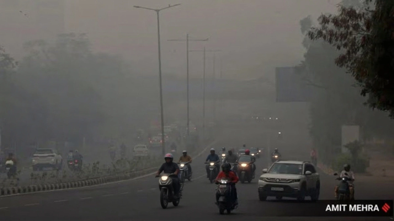
When India Meteorological Department raised red alerts on Tuesday, October 21, 2025, the city of Chennai and a string of coastal districts were slapped with what officials termed a textbook northeast monsoon surge.
Within the first 24 hours, the department recorded 149 mm of rain in Ramanathapuram district, 90 mm in Nagapattinam, and 63.5 mm across parts of Chennai‑South, prompting fears of flash floods, crop loss and traffic paralysis.
Adding a political eye to the brewing crisis, Udhayanidhi Stalin, Deputy Chief Minister of Tamil Nadu toured ongoing water‑way upgrades in south Chennai, inspecting the Rs 27 crore Okkiam Madhavi canal project and fresh desilting work at Kannagi Nagar.
Monsoon Surge and Immediate Impacts
The IMD’s subdivision‑wise warning system flagged “Extremely Heavy Rain Thunderstorm & Lightning, Squall etc.” for Day 1 (Oct 21) and “Extremely Heavy Rain” for Day 2 (Oct 22) across 12 districts, including Pudukottai, Thanjavur, Tiruvarur, Mayiladuthurai and Cuddalore. In addition, the Union Territories of Puducherry and Karaikal are under the same umbrella of alerts.
According to a Times of India report dated Oct 21, the heavy‑to‑very‑heavy rain is expected to linger until Oct 23, especially over coastal stretches and interior districts such as Tiruvallur and Cuddalore. The storm system also sent a faint ripple to neighbouring states: Kerala’s Idukki and Wayanad regions are bracing for intense showers from Oct 22‑24, while coastal Karnataka faces intermittent downpours through Oct 25.
Wind gusts have topped 45 km/h in parts of Chennai, rattling windows and knocking down a few temporary structures. Power outages were reported in three Chennai suburbs, though crews had the lights back on within six hours.
State’s Flood‑Mitigation Measures
Stalin’s inspection highlighted a multi‑pronged approach: deepening and widening existing canals, laying covered concrete channels, installing new storm‑water drains, and desilting estuarine inlets. The Okkiam Madhavi canal, slated for completion by March 2026, is being widened from 7 m to 12 m and its bed is being cleared of 4,200 cubic metres of silt.
Meanwhile, the Tamil Nadu State Emergency Management Department (TNSMART) projected hyper‑local rainfall of 170 mm in Thangachimadam and 143 mm in Mandapam, both within Ramanathapuram. In response, the department pre‑positioned 12 mobile pumping units and stocked sandbags at key junctions.
“We are not waiting for the waters to rise; we are already pulling the plug on potential flood pathways,” Stalin told reporters on site, adding that the state has allocated an extra Rs 5 crore for emergency relief in the next two weeks.
Agricultural Fallout and Rural Concerns
Farmers in Tirunelveli district reported that relentless downpours have submerged paddy fields, threatening an estimated 1,200 hectares of standing crop. Local farmer R. Murugan said, “We planted the rice in early October expecting a mild monsoon. Now the water is knee‑deep, and we fear total loss.”
Preliminary damage assessments suggest that up to 30 % of the season’s expected yield could be lost, potentially driving rice prices up by 8‑10 % in regional markets. The state’s agricultural department has promised compensation of Rs 12 per kilogram for affected farmers, pending verification.
Climatologist Dr. Ravi Menon of the Indian Institute of Tropical Meteorology warned that “the 2025 northeast monsoon is delivering precipitation levels comparable to the 2015 event, which caused unprecedented flooding in Chennai.” He added that rising sea surface temperatures are intensifying the monsoon’s moisture‑laden currents.
Regional Weather Outlook Across South India
- Kerala & Mahe: Very heavy rain expected Oct 22‑24, especially in Idukki, Wayanad, Kozhikode and Malappuram.
- Karnataka (Coastal & Interior): Intermittent downpours through Oct 25; Bengaluru, Mysuru and Hassan may face thunderstorms on Oct 24‑25.
- Andhra Pradesh & Rayalaseema: Continuous wet weather through the week, with very heavy rain in Chittoor, Kadapa and Nellore between Oct 22‑25.
- Telangana: Heavy rain forecast Oct 23‑25, accompanied by lightning and gusty winds.
- Andaman & Nicobar Islands: Multiple spells of rain on Oct 21 and again Oct 24‑26, with thunderstorms hitting maritime routes.
The broader pattern is part of the active phase of the northeast monsoon season, which runs from October to December across southern India. Meteorologists are also watching for possible cyclonic spin‑ups, though none have been flagged in the current Green Alerts covering Oct 21‑27.
What’s Next for Tamil Nadu and Beyond
Given the IMD’s prediction of “Extremely Heavy Rain” for Day 2, authorities have urged residents in low‑lying neighborhoods to keep evacuation routes clear and to relocate valuables to higher ground. Health officials warned of water‑borne diseases, especially dengue and leptospirosis, and have set up rapid‑response clinics in Chennai and Ramanathapuram.
In the longer term, the state plans to fast‑track the coastal flood‑resilience project, a Rs 3,500 crore investment aimed at constructing sea‑walls and elevating critical infrastructure. The project, slated for completion by 2029, is expected to reduce flood‑related damages by up to 45 % according to a recent feasibility study.
For now, residents are bracing for more rain, keeping an eye on daily bulletins, and hoping that the intensified monsoon will soon give way to the milder, dryer days that follow the season’s peak.
Key Facts
- Red alerts issued for 12 Tamil Nadu districts on Oct 21, 2025.
- Ramanathapuram recorded 149 mm of rain; Nagapattinam 90 mm; Chennai‑South 63.5 mm.
- Deputy CM Udhayanidhi Stalin inspected a Rs 27 crore canal‑renovation project.
- TNSMART predicts 170 mm in Thangachimadam and 143 mm in Mandapam.
- Projected agricultural loss: up to 30 % of paddy crop in Tirunelveli.
Frequently Asked Questions
How will the heavy rain affect daily life in Chennai?
Roads in low‑lying areas are expected to become water‑logged, causing delays in public transport and occasional power outages. Residents are advised to keep sandbags handy, avoid walking through standing water, and follow updates from the Chennai Municipal Corporation.
What measures is the Tamil Nadu government taking to curb flooding?
The state has accelerated canal‑deepening projects, deployed mobile pumps to flood‑prone villages, and pre‑positioned sandbags. An additional Rs 5 crore has been earmarked for emergency relief, and the Rs 27 crore Okkiam Madhavi canal upgrade is on track for a March 2026 completion.
Are farmers eligible for compensation?
Yes. The Tamil Nadu agricultural department has promised a compensation of Rs 12 per kilogram for damaged paddy, subject to verification by district officers. Applications must be submitted within 30 days of the flood event.
What is the outlook for neighboring states?
Kerala, Karnataka, Andhra Pradesh, Telangana and the Andaman & Nicobar Islands are all in the path of the same monsoon system. They can expect heavy to very heavy rain through the end of the month, with thunderstorms likely over interior districts such as Bengaluru and Hyderabad.
Could this monsoon develop into a cyclone?
Meteorologists say the current system lacks the low‑pressure core needed for cyclogenesis, but they are monitoring sea‑surface temperatures that could fuel a tropical depression later in the week. Residents should stay tuned to the IMD’s Green Alerts for any updates.